Tsunami hazard on Jamaica:
Analysis of the currently available data on various natural disasters in Jamaica suggests that tsunami hazard is not as significant as hazards due to landslides, riverine flooding, hurricane and earthquakes. However, Jamaica has a history of tsunamis that have affected the coastline since 1688 causing loss of life and destruction of property.
(Note: records are available dating back to 1688 ).
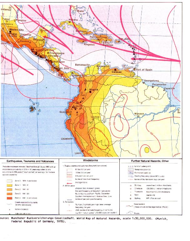
Jamaica's onshore and offshore geologic setting makes the coastline particularly vulnerable to tsunami hazard. The World Map of Natural Hazards (1988) prepared by Munich Re shows the entire coastline of Jamaica exposed to tsunamis. Since most of the urban population in Jamaica resides in coastal areas any future tsunami is likely to have a disastrous impact because of the development in the coastal areas. It therefore makes sense to be aware of this hazard while determining the acceptable risks in the coastal settlements.
Lander has listed the following tsunami events in Jamaica:
. . . Port Royal, March 1, 1688;
. . . Port Royal and eastern Jamaica, June 7, 1692;
. . . north coast, June 11, 1766;
. . . Savanna-La-Mar, October 2, 1781,
Accounts of some of these events are not comprehensive and more research is needed to validate their practical and site specific use.
The Caribbean region is also vulnerable to teletsunamis, which may have their origin outside of the region. For example, James Lander has reported that the tsunami generated by the November 1, 1755 Great Lisbon Earthquake, Portugal
"… sent waves into the Caribbean with amplitudes of 7m at Saba, 3.6m at Antigua and Dominica, 4.5m at St.Martin, leaving a sloop anchored in 4.6m of water laying broadside on the dry bottom, and 1.5-1.8m at Barbados. There are no reports for their effects in other islands in the Caribbean, but with waves of these sizes, they probably affected most of the islands." We do not have data on the return time of this event. Lander has further stated that, " Such tsunamis will have about eight hours of lead time before they arrive from the source of the Lisbon tsunami, and have long periods of up to an hour. The danger period may last for upto twelve hours".
Kick'Em Jenny is a submarine volcano, located between Grenada and Carriacou in the Lesser Antilles volcanic arc. It erupts regularly. A tsunami travel time chart prepared by Lander shows that a tsunami generated by this volcano would take about 150 minutes to reach Kingston.