UWI to Launch Caribbean Disaster Risk Atlas

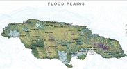
The Institute for Sustainable Development, The University of the West Indies will on Monday, June 25, 2012 at 10 am launch the Caribbean Disaster Risk Atlas at the Mona Visitors’ Lodge and Conference Centre, UWI, Mona. The Atlas is a Project funded by the World Bank and implemented by UWI. The Atlas will provide flooding and earthquake data for three Caribbean countries namely: Jamaica, Barbados and Grenada in order to improve on the management of these risks.
The Caribbean Risk Atlas project is designed to build capacity in the Region, to analyse disaster risks in terms of potential losses and to enable the use of this type of analytical tool in the development of comprehensive risk management strategies. The project offers to technical experts and general users in the Caribbean, an interactive disaster risk atlas for flooding and seismic activities in the first stage through an open source platform.
Key stakeholders and the public are invited to attend the Launch. For more information interested persons may telephone 977-5545.
