| 1 | Cover, Title |
| 2 | Index (Contents) |
| 3 |
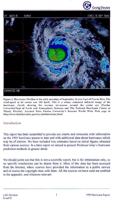
Introduction FIG.1 - Hurricane Marilyn |
|
open |
|
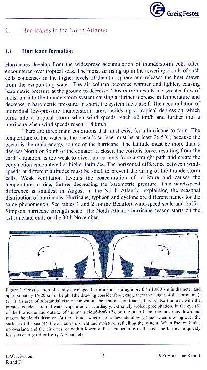
| 5 | 1.1 - Hurricane formation |
| 6 | 1.2 - Hurricane prediction |
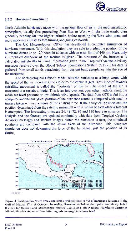
| 7 | 1.2.2 - Hurricane movement |
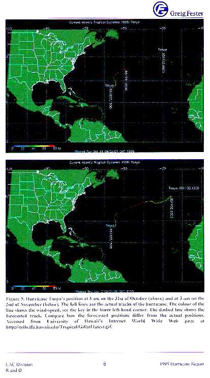
| 8 | FIG.5: Hurricane Tanya |
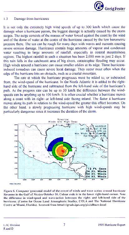
| 9 | 1.3 - Damage from hurricanes |
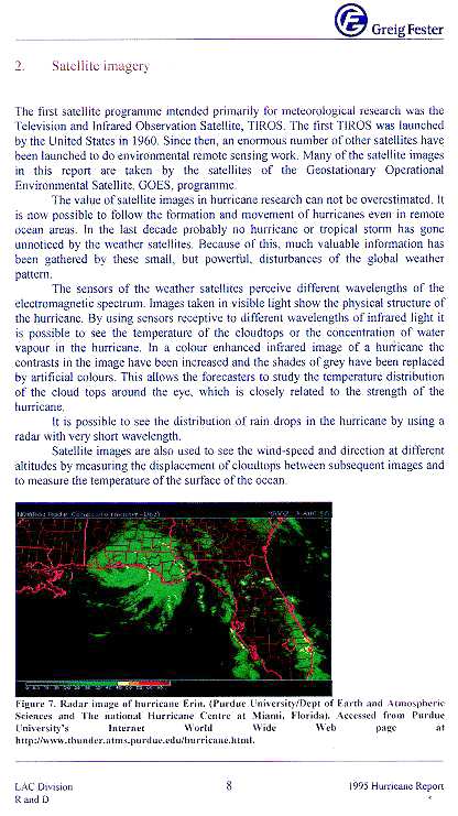
| 10 | 2. Satellite imagery |
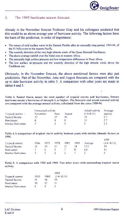
| 11 | 3. The 1995 hurricane season forecast |
| 12 |
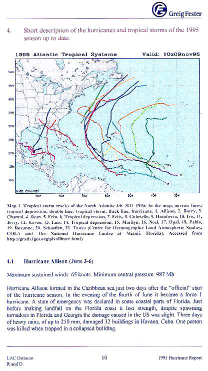
4. Short description; MAP : Tropical storm tracks, N. Atlantic 3/6 - 8/11, 1995 |
| 13 | cont. |
| 14 |
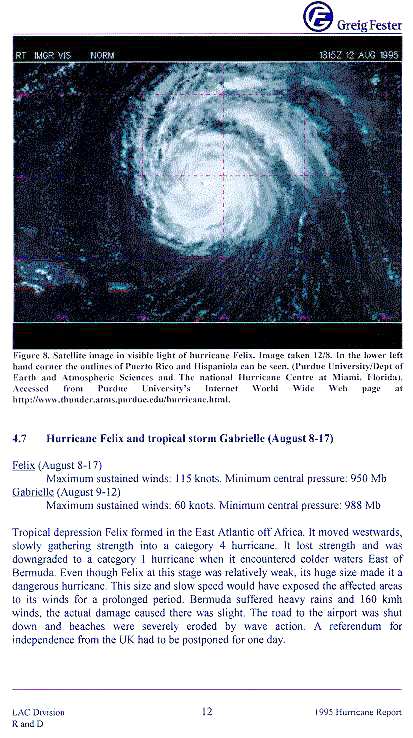
cont. FIG.8: Hurricane Felix Image |
| 15 | cont. |
| 16 |
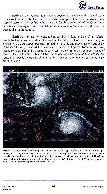
cont. FIG.9: Hurricane Iris image |
| 17 |
cont. (Hurricane Luis, island by island) |
| 18 |
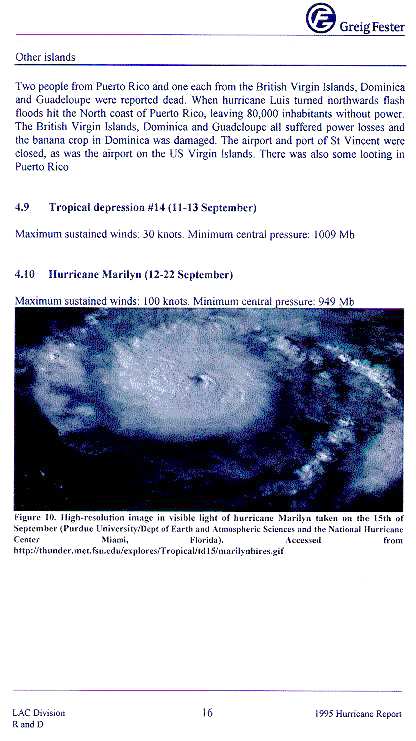
cont. FIG.10: Hurricane Marilyn image |
| 19 | cont. |
| 20 | cont. |
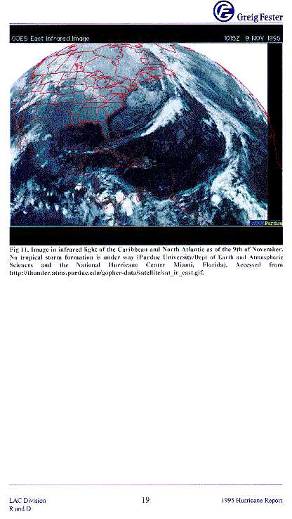
| 21 | FIG.11: I.R. image of Nov.9: no storms |
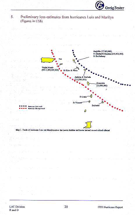
| 22 | 5. Preliminary loss estimates from hurricanes Luis and Marilyn |
| 23 |
Appendix (References and Links) |
| first version: 19990726 BLO |
|