LANDSLIDES RELATED TO
PRECIPITATION IN
RAFI AHMAD
DAVID J. MILLER
DEBORAH-ANN C. ROWE
DEPARTMENT OF GEOGRAPHY AND GEOLOGY
THE UNIVERSITY OF THE
MONA,
INTRODUCTION:
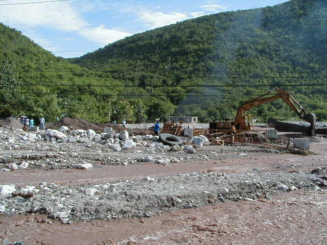
Heavy rainfall from the rain storms of 27 October- 5 November 2001, 22 May – 2 June 2002, 17-24 September ( Isidore) and 27- 30 September ( Lili) 2002 triggered hundreds of landslides on steep slopes of the Port Royal and Blue Mountains in eastern Jamaica. Rainfall patterns obtained from the satellite showed that the pattern of damage was generally consistent with the area of heaviest rainfall.
|
|
|
Fig. 1. The NOAA satellite image of Tropical
Storm Lilli taken at From: GoPBI.com |

Following the recent rainstorms we visited some of the severely affected
drainage basins in the are. Our field data and historical records indicate that
previous flooding and debris-flow events of similar magnitude to that of October
2001, and May-September 2002 have occurred throughout this region.
This paper examines
the recurrent processes of landslides of flow type and sediment deposition in
the eastern section of the island and suggests mitigation measures.
Landslide characteristics include: (a) dominant varieties
were debris flows, debris avalanches, debris slides and mud flows originating
on mountain-sides with landslide scars being generally located at the steepest
section of the slope; vegetation was uprooted (b) landslide debris followed
pre-existing depressions/channels, (c) debris flows and debris avalanches
originating in small and steep channels caused sediment surges which along
with organic matter blocked channels creating temporary landslide dams; these
were breached within couple of hours, (e) landslide distribution was irregular
suggesting variation in rainfall intensity over short distances, (f) erosion of
stream channels was spectacular and contributed significant amount of
sediments to total sediment yield. Landslide debris was deposited in
several different niches. These included deposits at the base of slopes,
channel deposits, debris fans, deposits where mountain streams were
blocked by road culverts, and flood plain deposits in the lower reaches of the
major rivers.
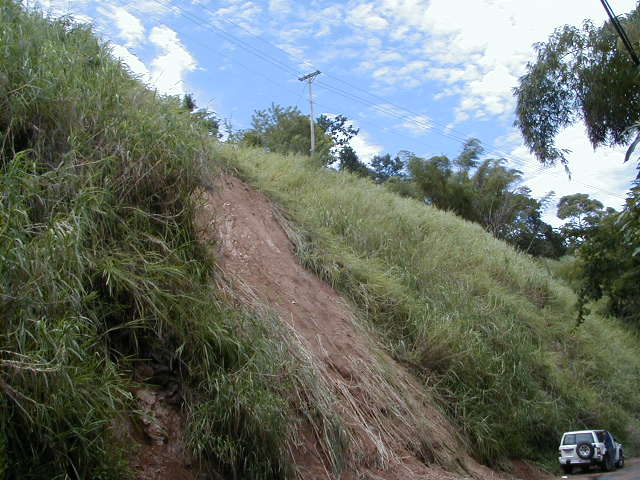
Most landslides initiated as thin earth (soil) slides or debris slides (soil with pieces of rock), as indicated by shallow sliding surfaces within soil or weathered, and jointed bedrock.
Figure 2 shows a shallow earth slide in decomposed
granodiorite near Temple Hall,
Shallow slides composed of loose soil and rock liquefied into debris flows/ mud flows with the addition of hill slope runoff or the water from within the channels. This process of debris-flow mobilization initiating from shallow slides is a widely recognized process. Large rock slides, and rotational slides of earth or rock, were also observed.
Mud flows in
completely decomposed granodiorite exposed along the 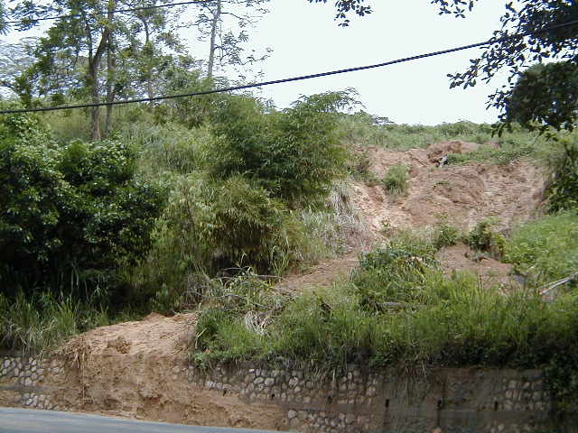
Mobilization of debris slides into mudflows is shown on
Figures 4 to 6 from the Broadgate area,
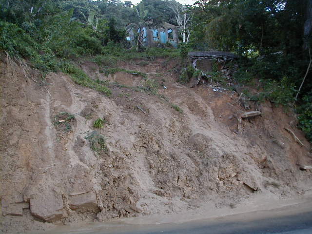
While
traveling down steep hillside paths, the debris flows entrain the colluvium
that is resident on hill slopes. Upon entering the main channels, the debris
flows incorporated alluvium from the channel beds and also sediments from collapsing
channel banks. Grain size in debris flows range e from fine-grained clastics to
extremely large boulders as seen in Figure 7 from Belcarres in 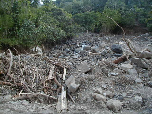
In the
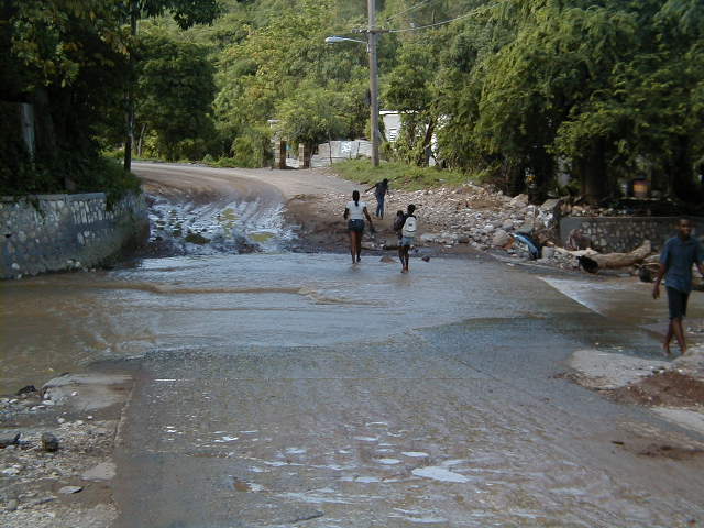
DAMAGE:
Landslide
damage to communities and infrastructure was extensive in
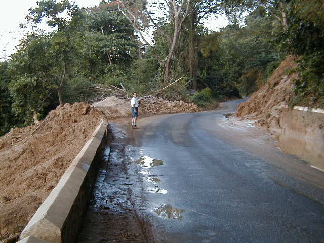
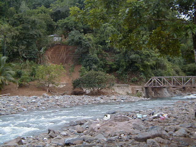
Figure 8 shows a view of the breached eastern end of the Yallahs Fording .( Photo taken on1st October 2002.)
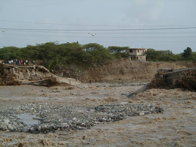
Figure 9 shows the 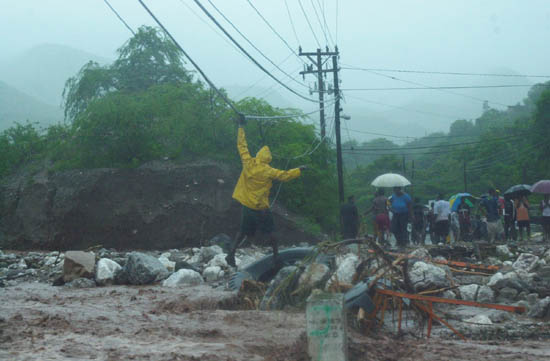
FROM: THE GLEANER WEBSITE Damage caused by Tropical Storm Lili in
Photographers:Ian Allen and Junior Dowie
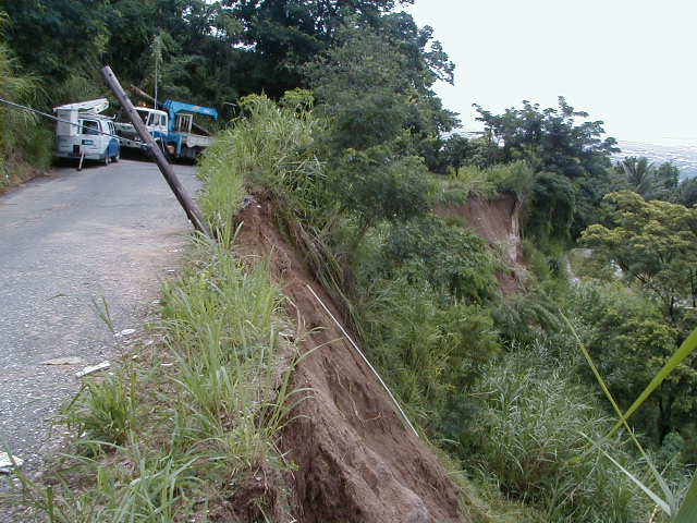
Figure 10. Eastern approach to the
Electricity and telephone poles damaged by debris flows are seen in Figure 11.
This location is near the intersection of
|
|
|
Fig. 12. Residents of Bull Bay, Jamaica, take shelter
from flood water on Monday, Sept. 30. In From: GoPBI.com |
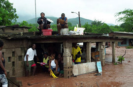
Figure 13 shows communities located close to the 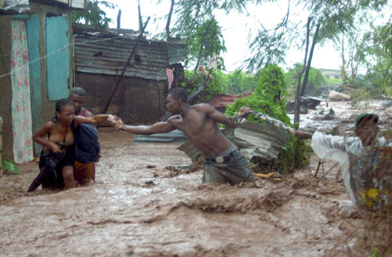
FROM THE
GLEANER WEBSITE:
Damage caused
by Tropical Storm Lili in
Photographers:Ian Allen and Junior Dowie
Debris and water impact on buildings, roads and other structures may be reduced if structures were built with their length aligned parallel to the direction of flow. This type of construction tends to minimize the width of a house/building exposed to a debris flow. This practice is recommended for all those communities located on debris fans.
Figure 14 is an example of a house with its length parallel
to the flow direction. Although a weak construction, this structure remained
intact following the debris flows of
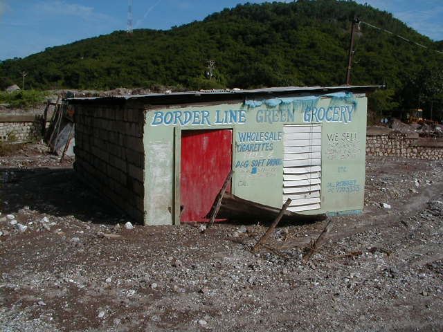
Figure 15 shows a house and a van partially engulfed by the
debris in the
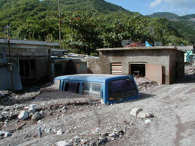
Figure 16 is an example of the house with its width oriented perpendicular to the flow path. Accumulation of debris and vegetation is seen along the wall facing the flow path.
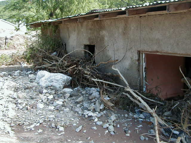
Figure 17
Debris flows engulfed houses and church, October 2001, Belcarres, 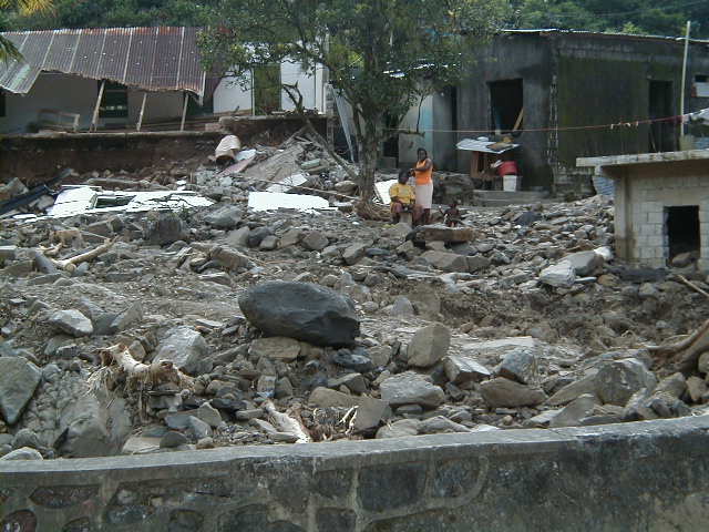
Figure 18
Debris flow Damage in the
Bybrook area, 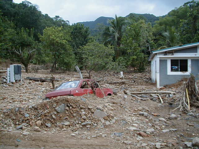
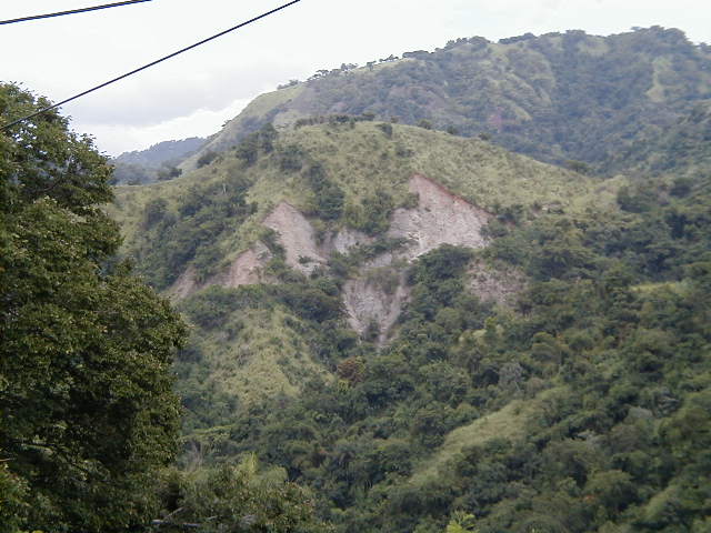
Landslides were abundant on steep slopes within all
lithologies. Some hillsides , as in Figure 19
were denuded by single or
coalescing failures as in the watersheds
north of Norbrook in St. Andrew. Several old and stabilized landslide scars are
also visible in the background.
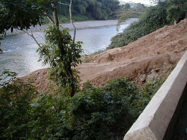
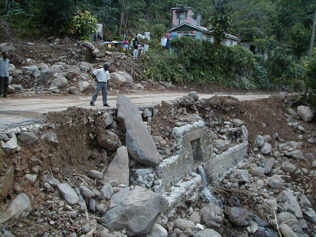
Following the 25-29 October 2002 rainfall the
Figure 20 is an upstream view of the silted
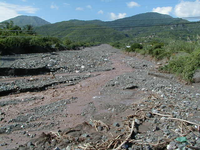
Figure 21 is a view of the
PERFORMANCE OF CIVIL
ENGINEERING STRUCTURES IN THE WAKE OF HEAVY RAINFALL
The
flooding processes in
A survey of damaged bridges and culverts in
Figure 22
Blocked culvert on the
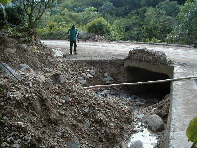
Figure 23. Culvert on a debris channel, Bybrook,
Figure
24.
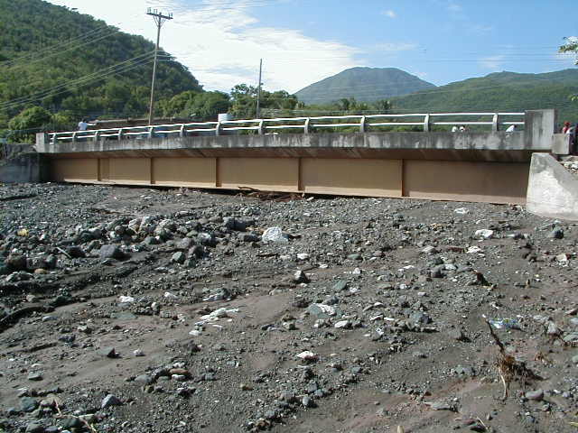
Debris flows blocked the channel upstream of the bridge in October 2001 resulting in damage to the structure and flooding in the adjoining community.
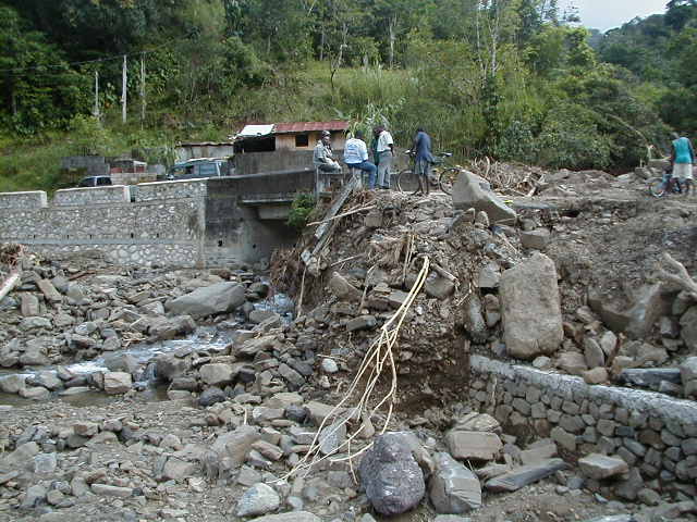
Figure 25.
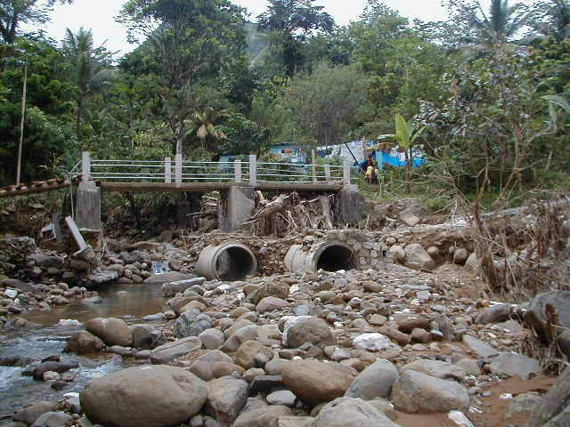
Figure 26.
A view of the 29th October 2002 debris flows that
blocked the 10 Mile Bridge,
The size of the bridge is inadequate to allow for the
passage of debris and plant material. With the channel being completely blocked
by tree trunks, branches and debris etc., avulsion took place and debris and
water started moving west toward the road and houses located on the right-hand
side of the channel in the community.
Design
of bridges and culverts in this area must take into consideration the large
volume of debris and vegetation that are being carried into the channels. The
structures designed for accommodating only pure water floods are unsuitable as
they offer a resistance to the passage of debris and vegetation, for example,
the current flooding problem at the 10 Mile Bridge on Highway A4.
It appears that
fording is a better alternative to culverts and small-scale bridges as these
structures do not obstruct the flows and are easily cleared by a front end
loader, for example, the fording on Spring Gut east of
CONCLUSIONS
The socio-economic impact and losses to infrastructure, private property and agriculture in the wake of 2001-2002 high magnitude rainstorm events were catastrophic. Road network and water supply systems suffered serious disruption.
Landslide deposits have caused severe indirect damage and hazards
manifested in damming of the rivers and sudden debris supply to river channels.
For example, sediments generated by October 2001 event raised the river bed at Bybrook
and
Excessive coarse sediment supply to channels tends to decrease channel depth and an increase in the frequency of overbank flooding in the lower reaches of these channels, that is fan areas where most of the development takes place.
Mitigation is necessary in order to minimize future losses from events of similar or greater magnitude.
It is considered important to establish rainfall intensity-duration thresholds for triggering of landslides.
DEBRIS FLOW MITIGATION MECHANISMS (Table 1)
- It is possible to reduce the effects of debris flows.
- Mitigation methods reduce the impact but may not necessarily eliminate the associated hazards and risks.
- Mitigation methods are broadly grouped as passive and active measures.
- PASSIVE MEASURES
(NON-STRUCTURAL) do not involve any direct engineering intervention
to either prevent or modify/control the event and are most affordable.
Following the identification and assessment of the hazard,
a public education programme may be mounted to advice the citizenry of the
vulnerability and risk.
Non-structural measures can be
especially cost effective in reducing hazards if the areas in question are
subject to frequent debris flows, e.g.,
A majority of houses/structures on the alluvial fans visited are built with their length oriented perpendicular to the flow direction. The impacts of debris and flood waters are likely to be minimized if houses were oriented with their length parallel to the flow. This would also allow for the construction of V-shaped debris deflection structures.
Recommendations are made to the effect that it is best to
avoid problem areas, relocation of existing houses etc. is proposed, or land
use regulations controls are applied to prevent further occupation. The final
decision, however, rests with the landowners/ state.
- ACTIVE MEASURES (STRUCTURAL) aim at controlling the movement of debris across the depositional fan by employing engineering methods and are therefore very costly.
An important aspect is to minimize the amount of debris
from entering into coastal environments where coral reefs and/or fishing
habitats may be adversely affected.
TABLE 1. PROPOSED
DEFENCIVE MEASURES AGAINST DEBRIS FLOW AND FLOODING IN
NOTE:These measures
may not be effective in case of a very high magnitude event.
(Modified from the approaches proposed by Hungr, O., and others, 1987, Debris flow defenses in British Columbia, Reviews in Engineering Geology, Vol. VII, p.201- 222.)
===============================================================
Measure Purpose
-----------------------------------------------------------------------------------------------------------
Passive Measures
1. Hazard mapping and zoning Restrict use of endangered
areas; public education
on acceptable risk, and interventions for a safer building practice.
(NOTE: Maps that delineate areas affected by debris flows and floods are available)
2. Warning systems: advance Facilitate
evacuation at times of danger
during event or post-event
(NOTE: This requires installation of, e.g., a Tripwire device, rainfall gauges in the watershed)
ACTIVE MEASURES
A. In source
areas
3. Revisit landuse practices/ Reduce debris by stabilization of debris sources.
execute an audit / find
innovative uses of sediments
(NOTE: Long-term solution)
4.
Reforestation Reduce loss of vegetation cover disturbed by
ever-increasing development activities in the watersheds.
(NOTE: Long-term solution)
5. Road construction
control Eliminate unstable cuts and fills that could act as
debris sources or initiation points.
B. In
transportation and deposition zone
(The zone between the mountain front and the debris
deposition area)
6. Open debris deposition basins; Control
the extent of depositional area by shaping dykes or walls and diking.
7. Closed retention barriers and Create
a controlled deposition space fronted by a
basins; full or partial volume straining structure and a spillway.
8. Raise the height
of the bridges Allows for the safe passage of debris under the
channel dredging and widening bridge
and through culverts
of culverts; create
fording.